May 7, Santa Nella to San Bruno
We were quite literally rocked to sleep last night as the wind came up and in fact, it was still blowing strongly when we got up this morning, our last day in California. With the van cleaned up and our bags packed we headed off to San Leandro, a mere two hours away.
We turned in the van at about 10:30, took a cab to the nearest B.A.R.T. (Bay Area Rapid Transit) station and made our way to a hotel near the airport to spend the night before boarding the plane to Toronto, bright and early tomorrow morning.
In total, we drove 3020 miles in the van and have walked 361,915 steps. We have been as far south and as far west as you can go in this state. We visited the northernmost city and traveled so far east that we were less than a couple of hundred miles from the Nevada border. We drove on eight lane highways and single lane roads and loved every minute of it.
It is difficult to write all the superlatives I would like to use to describe California. It is a state that has something for everybody...an ocean that provides not only a playground, but some of the most stunning scenery I have ever witnessed; mountains and hills with some of the oldest and tallest trees in the world; some so tall that it is difficult to see their tops; deserts where beautiful spring flowers seem to grow and flourish in spite of the dryness and scorching sun; cities with movie stars and far too much opulence for my taste and small towns with just one street and a general store.
The numerous State and National Parks offer not only great hiking, but camping, and organized walks and talks. California has done a great job of preserving historic sites and making them available to the public..everything from the early Spanish missions to prisons can be visited (for a price, of course).
Sports fans have no shortage of teams to watch...tickets to major league baseball games can be had for a reasonable price, while many Californians love the NHL teams in this state. People are seen fishing everywhere there is water and surfers can be found wherever there are big waves.
In short, I get it about California, I really get it!
Sent from my iPad
Saturday, May 7, 2011
May 6, Big Sur to Santa Nella
May 6, Big Sur to Santa Nella
 We started the day by driving north at a leisurely pace. We stopped at a restaurant that overlooks the Big Sur coastline and had coffee and a snack while admiring the view, watching sea lions and keeping a sharp eye out for whales. Unfortunately we didn't see any whales even though we were told that some had been spotted along the coast a short time ago.
We looked for a campsite that would enable us to do laundry and get the van ready for return tomorrow morning. Luckily we located one about an hour and a half away from San Leandro where we will return the van tomorrow morning.
En route to Santa Nella we drove through a town called Gilroy, a town that claims to be The Garlic Capital. I believe their claim because there was no mistaking the smell of garlic in the air. There were also numerous fruit and vegetable stands featuring garlic and fields and fields of garlic.
Outside of Gilroy we stopped at an outlet mall, browsed around and then headed off to our campsite. We did laundry, cleaned up the camper and watched a bit of tv. Tomorrow it's back to San Leandro and then on to San Francisco for the night.
Sent from my iPad
Friday, May 6, 2011
May 5, Big Sur
May 5, Big Sur
The river and the birds were competing for alarm clock status this morning. Being a mere 20 feet from the nose of the van, the river won. We ate breakfast at the picnic table and enjoyed the warm California sunshine. Feeling a bit lazy and laid back, we didn't leave Fernwood Resort and Campground until 10:59, with check out time being 11:00
We traveled south on highway 1 until we reached the hard to find, unmarked road to Pfeiffer Beach. It was well worth the two mile drive down the narrow twisty road, as at the end of the road were cliffs, towering over a spectacular stretch of sand. The arch shaped rock formation just off shore made for some great photos. I walked into the ocean up to my ankles...any further and a wetsuit would have been needed.
 After some time on the beach we drove to Julia Pfeiffer Burns Park to view the waterfall that spills over a cliff into the Pacific Ocean. The 200 foot falls is out of reach to humans and so the birds and other sea creatures have this stretch of beach all to themselves. It looked as if some of the gulls were standing in line to take a shower under the falls.
Feeling tired after an afternoon in the sun, we stopped at the Henry Miller Library for coffee. The library is a small bookstore that features the works of author Henry Miller who once lived in Big Sur.

We checked out two other campsites in the area before returning to Fernwood and another choice spot on the Big Sur River. After dinner we walked to the store for ice cream and to use the wifi spot to post this blog. We also got some firewood so that we could enjoy a fire as we listened to the sounds of the end of day in Big Sur.
Tomorrow we will start our trek back towards San Francisco and San Leandro where we return the camper on Saturday morning.
Sent from my iPad
The river and the birds were competing for alarm clock status this morning. Being a mere 20 feet from the nose of the van, the river won. We ate breakfast at the picnic table and enjoyed the warm California sunshine. Feeling a bit lazy and laid back, we didn't leave Fernwood Resort and Campground until 10:59, with check out time being 11:00
We traveled south on highway 1 until we reached the hard to find, unmarked road to Pfeiffer Beach. It was well worth the two mile drive down the narrow twisty road, as at the end of the road were cliffs, towering over a spectacular stretch of sand. The arch shaped rock formation just off shore made for some great photos. I walked into the ocean up to my ankles...any further and a wetsuit would have been needed.
 After some time on the beach we drove to Julia Pfeiffer Burns Park to view the waterfall that spills over a cliff into the Pacific Ocean. The 200 foot falls is out of reach to humans and so the birds and other sea creatures have this stretch of beach all to themselves. It looked as if some of the gulls were standing in line to take a shower under the falls.
 Feeling tired after an afternoon in the sun, we stopped at the Henry Miller Library for coffee. The library is a small bookstore that features the works of author Henry Miller who once lived in Big Sur.

We checked out two other campsites in the area before returning to Fernwood and another choice spot on the Big Sur River. After dinner we walked to the store for ice cream and to use the wifi spot to post this blog. We also got some firewood so that we could enjoy a fire as we listened to the sounds of the end of day in Big Sur.
Tomorrow we will start our trek back towards San Francisco and San Leandro where we return the camper on Saturday morning.
Sent from my iPad
Wednesday, May 4, 2011
May 4, Santa Cruz to Monterey and Big Sur
May 4, Santa Cruz to Monterey and Big Sur
We awoke to bright sunshine today and after shows and breakfast we left for the Monterey Bay Aquarium. We easily found a place to park and walked down Cannery Row. This area of Monterey used to be well known for sardine canning. Due to over fishing and the fact that sardines were not as well liked after the war, the industry collapsed. today the street is lined with shops and restaurants and of course, the aquarium.
 The aquarium was so much fun. Not only that, we learned a lot. We saw and learned about seahorses, sea otters, sharks, flamingoes, penguins and many, many other unique sea creatures. Did you know that the male seahorse is the only male of any species that gets pregnant, carries the babies and gives birth to them! The seahorse exhibit was probably the most fascinating.

After three hours at the aquarium we left Monterey with big smiles on our faces while saying, "Wow, that was awesome".
The highway to Big Sur was closed the last time we drove down to this area due to landslides that are very common on this stretch of highway. Big Sur is one of the most popular scenic drives in California. The area is sparsely populated and is mostly state park lands. On one side are dramatic cliffs and rocks that jut up out of the ocean and on the other side are dense forests. We are staying at a campsite that is on the banks of the Big Sur River with numerous hiking trails nearby.
We plan to check out the hiking trails in the morning.
Sent from my iPad
We awoke to bright sunshine today and after shows and breakfast we left for the Monterey Bay Aquarium. We easily found a place to park and walked down Cannery Row. This area of Monterey used to be well known for sardine canning. Due to over fishing and the fact that sardines were not as well liked after the war, the industry collapsed. today the street is lined with shops and restaurants and of course, the aquarium.
 The aquarium was so much fun. Not only that, we learned a lot. We saw and learned about seahorses, sea otters, sharks, flamingoes, penguins and many, many other unique sea creatures. Did you know that the male seahorse is the only male of any species that gets pregnant, carries the babies and gives birth to them! The seahorse exhibit was probably the most fascinating.
After three hours at the aquarium we left Monterey with big smiles on our faces while saying, "Wow, that was awesome".
The highway to Big Sur was closed the last time we drove down to this area due to landslides that are very common on this stretch of highway. Big Sur is one of the most popular scenic drives in California. The area is sparsely populated and is mostly state park lands. On one side are dramatic cliffs and rocks that jut up out of the ocean and on the other side are dense forests. We are staying at a campsite that is on the banks of the Big Sur River with numerous hiking trails nearby.
We plan to check out the hiking trails in the morning.
Sent from my iPad
May 3, Santa Cruz
May 3, Santa Cruz
Our day started with a one hour beach hike beginning at the Franklin Point Trailhead. On our way to the trailhead we watched a deer in the field and heard lots of birds. The trail led us over a marshy area, over sand dunes and finally to the beach. We walked along the beach and followed the trail up over the rocks to the edge of a rocky cliff. It was windy, the waves were strong, the water cold but the sun was bright.
When we returned to the campground we readied the RV for takeoff, unplugging the power, water and grey water hoses. We decided to spend the rest of the day in Santa Cruz and go to the Aquarium in Monterey tomorrow.
 Along the way we noticed a sign that said "free jam tasting at organic farm". I know that many people visit California for the wine tasting at the many vineyards, but to us, the jam tasting was much more appealing. What a great place it turned out to be. We not only sampled jams, we ate truffles, a gigantic strawberry scone and drank organic coffee and Mexican hot chocolate. To me, one of the best things about this place was that, even though there were a few staff people milling about, paying for one's purchases was on the honor system...an open cash register...yes, in a place where you cannot pump gas until you pay first, there was an open cash register! It was amazing.
The drive to the Santa Cruz Boardwalk didn't take long and we easily found a place to park. This beach amusement park has been around for over 100 years.
 Spring breaks are over and summer vacations have yet to begin, and so the Boardwalk was not busy. We walked the boardwalk and then to the end of the pier, which is lined with restaurants, fish markets and shops. Lots of people fish from the wharf, while sea gulls, seals and sea lions wait for someone to drop something. We chatted with a guy who runs a hot dog stand here in the summer who told us that over 2 million people visit the area every year and that we were smart to be visiting in the spring. Even though it is still spring it was very hot today...high 80's.
We tried our luck at the arcade shooting gallery, listened to people scream on the rides and walked the rest of the boardwalk. The GPS navigated us to our next campsite, where I took advantage of the heated pool and the hot tub. Tomorrow we will visit the Monterey Aquarium before heading to Big Sur.
Sent from my iPad
Our day started with a one hour beach hike beginning at the Franklin Point Trailhead. On our way to the trailhead we watched a deer in the field and heard lots of birds. The trail led us over a marshy area, over sand dunes and finally to the beach. We walked along the beach and followed the trail up over the rocks to the edge of a rocky cliff. It was windy, the waves were strong, the water cold but the sun was bright.
When we returned to the campground we readied the RV for takeoff, unplugging the power, water and grey water hoses. We decided to spend the rest of the day in Santa Cruz and go to the Aquarium in Monterey tomorrow.
 Along the way we noticed a sign that said "free jam tasting at organic farm". I know that many people visit California for the wine tasting at the many vineyards, but to us, the jam tasting was much more appealing. What a great place it turned out to be. We not only sampled jams, we ate truffles, a gigantic strawberry scone and drank organic coffee and Mexican hot chocolate. To me, one of the best things about this place was that, even though there were a few staff people milling about, paying for one's purchases was on the honor system...an open cash register...yes, in a place where you cannot pump gas until you pay first, there was an open cash register! It was amazing.
The drive to the Santa Cruz Boardwalk didn't take long and we easily found a place to park. This beach amusement park has been around for over 100 years.
 Spring breaks are over and summer vacations have yet to begin, and so the Boardwalk was not busy. We walked the boardwalk and then to the end of the pier, which is lined with restaurants, fish markets and shops. Lots of people fish from the wharf, while sea gulls, seals and sea lions wait for someone to drop something. We chatted with a guy who runs a hot dog stand here in the summer who told us that over 2 million people visit the area every year and that we were smart to be visiting in the spring. Even though it is still spring it was very hot today...high 80's.
 We tried our luck at the arcade shooting gallery, listened to people scream on the rides and walked the rest of the boardwalk. The GPS navigated us to our next campsite, where I took advantage of the heated pool and the hot tub. Tomorrow we will visit the Monterey Aquarium before heading to Big Sur.
Sent from my iPad
Tuesday, May 3, 2011
May 2, Manchester Beach yo Santa Cruz
May 2, Manchester Beach to Santa Cruz
We left Manchester Beach early this morning heading south on Highway 1. Highway 1 is considered one of the most scenic drives in the United States. Today's drive on Highway 1 did not disappoint. Although the road was often narrow and always twisting and turning the scenery was spectacular. On one side was the ocean where whales, sea lions and seals, along with surfers share the cold Pacific.
 We approached San Francisco from the north and in so doing, got to drive across the Golden Gate Bridge. It costs $6.00 to cross. We continued on down the coast until we reached the Santa Cruz KOA, an eco campground. We can see the ocean from our site.
Since the horses here are booked for the next couple of days, we decided to treat ourselves to dinner to the restaurant on the grounds. They serve all organic, locally grown produce and the most decadent chocolate lava cake that I have ever eaten.
We returned to the camper after dinner and tuned the iPad to CBC radio to listen to the very sad story of the election at home. Tomorrow we will spend some time on the beach before heading to the Monterey Bay Aquarium.
Sent from my iPad
We left Manchester Beach early this morning heading south on Highway 1. Highway 1 is considered one of the most scenic drives in the United States. Today's drive on Highway 1 did not disappoint. Although the road was often narrow and always twisting and turning the scenery was spectacular. On one side was the ocean where whales, sea lions and seals, along with surfers share the cold Pacific.
 We approached San Francisco from the north and in so doing, got to drive across the Golden Gate Bridge. It costs $6.00 to cross. We continued on down the coast until we reached the Santa Cruz KOA, an eco campground. We can see the ocean from our site.
 Since the horses here are booked for the next couple of days, we decided to treat ourselves to dinner to the restaurant on the grounds. They serve all organic, locally grown produce and the most decadent chocolate lava cake that I have ever eaten.
We returned to the camper after dinner and tuned the iPad to CBC radio to listen to the very sad story of the election at home. Tomorrow we will spend some time on the beach before heading to the Monterey Bay Aquarium.
Sent from my iPad
Monday, May 2, 2011
May 1, Trinidad to Manchester Beach
May 1, Trinidad to Manchester Beach
We awoke this morning to the sound of sea lions barking on the shore across from the RV Park. It was another cool morning, but again, it warmed up quickly and before too long we were wearing shorts.
After a stop in Eureka for a few groceries we drove to the start of the "Avenue of the Giants" a scenic 31 mile drive through a forest of giant trees. We stopped several times on the scenic drive to admire some of the sights. We saw the "immortal tree"; a giant redwood that has survived a flood, a fire and someone's attempt to chop it down. In Redcrest we visited the "eternal treehouse", a huge living tree stump that contains a cavern caused by fire centuries ago.

 As we motored along this drive we came upon a roadblock. Apparently an annual marathon was taking place, thus blocking us from about 10 miles of the "Avenue of the Giants". We got back on the scenic route and at Myers Flat visited the "drive through tree". We were too big to drive through but we did watch a mid size car go through.
In Piercy we walked through a "One Log House" a complete home (32 feet long) carved out of a 2100 year old redwood. It was hollowed out by hand in 1946 and includes a living area, kitchen, bathroom and bedroom. In the eight month process of hollowing the log, enough wood chips were produced to build a traditional five bedroom home!
 Leaving the "Avenue of the Giants" we curved along the coast, driving up and down hills, slowing down for the many switchbacks. There were sea lions on the rocky shore and people at all the beaches we passed. This area is referred to as the "banana belt" of the north coast because there is very little fog here, whereas north of Mendicino County and south of Mendicino County fog frequently hugs the coastline.
We settled for the night at a KOA on Manchester Beach in the hopes of going horseback riding on the beach tomorrow. Unfortunately the horses are off on Monday and so we will have to rethink Monday. We did walk to the beach after dinner and enjoyed a beautiful sunset.
Sent from my iPad
We awoke this morning to the sound of sea lions barking on the shore across from the RV Park. It was another cool morning, but again, it warmed up quickly and before too long we were wearing shorts.
After a stop in Eureka for a few groceries we drove to the start of the "Avenue of the Giants" a scenic 31 mile drive through a forest of giant trees. We stopped several times on the scenic drive to admire some of the sights. We saw the "immortal tree"; a giant redwood that has survived a flood, a fire and someone's attempt to chop it down. In Redcrest we visited the "eternal treehouse", a huge living tree stump that contains a cavern caused by fire centuries ago.

 As we motored along this drive we came upon a roadblock. Apparently an annual marathon was taking place, thus blocking us from about 10 miles of the "Avenue of the Giants". We got back on the scenic route and at Myers Flat visited the "drive through tree". We were too big to drive through but we did watch a mid size car go through.
In Piercy we walked through a "One Log House" a complete home (32 feet long) carved out of a 2100 year old redwood. It was hollowed out by hand in 1946 and includes a living area, kitchen, bathroom and bedroom. In the eight month process of hollowing the log, enough wood chips were produced to build a traditional five bedroom home!

We settled for the night at a KOA on Manchester Beach in the hopes of going horseback riding on the beach tomorrow. Unfortunately the horses are off on Monday and so we will have to rethink Monday. We did walk to the beach after dinner and enjoyed a beautiful sunset.
Sent from my iPad
Sunday, May 1, 2011
April 30, Arcata to Crescent City and Trinidad
April 30, Arcata to Crescent City and Trinidad
It was cool again this morning but the sun was shining, there was not a cloud in the sky and it soon warmed up to around 65 degrees. Our first stop was the Kuchel Visitor Centre, the southern entrance to the Redwood Forest. The park guide was very helpful and recommended several hikes, scenic drives and key lookoffs points.

As we entered the Park we stopped at a beach to take some pictures. A sign at the beach warned of "Dangerous Sneaker Waves that have killed four people since 2004. Never Turn Your Back on the Sea".
We hiked the Lady Bird Johnson Grove, a 1 1/2 mile walk through old growth redwoods and Douglas fir. Lady Bird Johnson dedicated the Redwood National Park in 1968.
 The scenic coastal drive was not open due to heavy rains this spring. However, we did drive the Newton B. Drury Scenic Parkway, a 10 mile not to be missed drive through the forest that features many trailheads and an a grove where elk graze. We were lucky enough to come upon a small herd of elk, some lying down, while the young ones grazed in the grove. Signs clearly stated "Do Not Approach Elk, Stay Behind Fence".
We stopped at a smoked salmon store in Klamath, a Yurok Indian Reserve. We sampled four kinds of smoked salmon and settled on three kinds for our picnic at Wilson Creek where we watched the waves crashing on the beach. Continuing along the scenic route we stopped at several look off points and stood in awe of the ocean before us.
We drove as far as Crescent City where we stopped for a coffee break before we headed back down the coast. On the drive back we stopped at a couple of trailheads and walked through more giant redwoods. These trees are so tall, so old and so big that everything around them is dwarfed. We took numerous pictures but it is difficult to capture the immenseness of these giants.

Another sign that we noticed along this route was "Tsunami Warning Zone". The Park brochures have a section on tsunamis and information on what to do if you feel an earthquake.
Our one last bit of excitement for the day was coming upon a bear crossing the road. It was great to see a black bear while in the van and not while walking on one of the trails.
We are staying at Sounds of the Sea RV Park tonight and will drive the Avenue of the Giants tomorrow.
Sent from my iPad
Saturday, April 30, 2011
April 29, Sacramento to Arcata

Luckily we had a full propane tank because the temperature dipped down to about 40 last night. However it warmed up quickly as we set out to head north. We traveled on the freeway for about two hours to reach the scenic drive from Redding to the Pacific Coast.
As we headed west we could see snow capped mountains in the distance and knew that we would have to get to what was on the other side of them. The mountains are part of the 2.1 million acre Shasta Trinity National Forest, the largest in California. This forest has 6278 miles of streams and rivers. The road curved and twisted alongside the Trinity River for many miles. We drove through dense forests, up mountains, down mountains and finally reached the coast.
We drove for six hours today and so were pleased to get a spot at the Mud River Rapids RV Park. Tomorrow we will drive through the Redwood Forest. A change of wardrobe is definitely in order...we will have to dig out the jeans and socks.
Sent from my iPad
Friday, April 29, 2011
April 28, Yosemite National Park to Sacramento
April 28, Yosemite National Park to Sacramento
It was cold last night. The temperatures often dip into the low 30's here at this time of year. Fortunately we have a great furnace, but unfortunately we were low on propane and therefore didn't have it turned up as high as we would have liked. One of the first things we did this morning was to fill the propane tank!
 Yosemite National Park consists of about 1200 square miles of wilderness, meadows, giant forests, enormous granite peaks and waterfalls. There are many scenic stops on the way to Yosemite Valley, and along with many others, we stopped frequently, took tons of picture, walked some of the trails and visited all the displays. We didn't do any serious hiking as we didn't have all the necessary equipment. The waterfalls in Yosemite are spectacular and due to lots of rain and snow this past winter the streams are full. As far as wildlife is concerned, we didn't see any bear but we did see deer, chipmunks and lots of birds.
As we left Yosemite we found ourselves comparing it to the other two National Parks that we visited; Joshua Tree and Sequoia. We both agreed that so far Joshua Tree is our favorite with Sequoia coming in second. Yosemite is amazing, but, in our opinion, just not as amazing as the other two we have visited.
We continued north and landed in Sacramento at around 5:30. We chose another KOA as we find them to be very well laid out, extremely clean and secure.
Tomorrow we will head for the last "must see" on our list: The Redwood Forest, fully aware that we will be leaving the warm temperatures and entering the 60 degree zone!
Sent from my iPad
Thursday, April 28, 2011
Aprl 27, Sequoia State Park to Midpines (Yosemite)
April 27, Sequoia State Park to Midpines (Yosemite National Park)
 We paid our $20. 00 fee and entered Sequoia State Park at around 10:30. We could see snow on the mountains far in the distance but had no idea that before the end of our day in Sequoia we would be walking on that snow. The road through the park is a gradual climb to over 8000 feet. Most of the hiking trails were closed due to snow so since we didn't bring our snowshoes (although we did see one family with theirs) our hiking was limited to a walk up a snow covered trail to see General Sherman' sTree. This giant sequoia tree is estimated to be 2500 years old and has a circumference of 103 feet. In volume of total wood, this is the world's largest tree.
 We drove through the Giant Forest, an area where all of the trees aspire to be as tall as General Sherman's Tree which stands at 275 feet. Standing at the base of one of those trees sure made me feel small. There were many scenic pull off sites along the drive and we took advantage of many to take pictures and just gaze at the spectacular views.
We programmed Richard (our GPS voice) to take us towards Yosemite and to a grocery store so that we could replenish our food supplies. We arrived at the Yosemite West/Mariposa KOA at around 6:30 and settled in for the night. Tomorrow we will visit Yosemite.
Sent from my iPad
Wednesday, April 27, 2011
April 26, Barstow to Three Rivers (Sequoia National Park)
April 26, Barstow to Three Rivers (Sequoia National Park)
Besides being half way between Las Vegas and Los Angeles and being near a ghost town, Barstow has one more claim to fame: outlet shopping. Although neither of us are shoppers we did have a few things on our "need" list and so we spent some time at the Barstow Outlet Mall and the outlet mall in Tulare. Our "need" lists are now empty.
Our goal for the day was to get as close to Sequoia National Park as possible. For the first hour or so, our drive was on more of the Mojave Desert where we saw the testing site for KIA and Hyundai automobiles, Edwards Air Force Base and the Marine Aircraft Test Site. There is definitely a military presence in the desert.

The transition from desert to fertile valley was sudden. It was as if we merely crossed a line and all of a sudden we were seeing grass, trees, rolling hills and farmland. We had entered the San Joaquin Valley. We came across a farm market that sold fresh fruit, dried fruit, nuts and dates. Needless to say, we filled a basket with goodies and had lots to munch on for the rest of the drive. We passed acres and acres of apple orchards, orange groves, lemon groves, grapefruit groves and vineyards. Unfortunately, we also passed farms for sale, boarded up buildings and idle factories.
We arrived at Three Rivers Hideaway RV Park at around 6. After dinner we walked to the river, took a couple of pictures and planned our day tomorrow. We will spend most of it in the Sierra Nevadas, Sequoia National Park where I understand the bears have come out of hibernation.
Sent from my iPad
Besides being half way between Las Vegas and Los Angeles and being near a ghost town, Barstow has one more claim to fame: outlet shopping. Although neither of us are shoppers we did have a few things on our "need" list and so we spent some time at the Barstow Outlet Mall and the outlet mall in Tulare. Our "need" lists are now empty.
Our goal for the day was to get as close to Sequoia National Park as possible. For the first hour or so, our drive was on more of the Mojave Desert where we saw the testing site for KIA and Hyundai automobiles, Edwards Air Force Base and the Marine Aircraft Test Site. There is definitely a military presence in the desert.

The transition from desert to fertile valley was sudden. It was as if we merely crossed a line and all of a sudden we were seeing grass, trees, rolling hills and farmland. We had entered the San Joaquin Valley. We came across a farm market that sold fresh fruit, dried fruit, nuts and dates. Needless to say, we filled a basket with goodies and had lots to munch on for the rest of the drive. We passed acres and acres of apple orchards, orange groves, lemon groves, grapefruit groves and vineyards. Unfortunately, we also passed farms for sale, boarded up buildings and idle factories.
We arrived at Three Rivers Hideaway RV Park at around 6. After dinner we walked to the river, took a couple of pictures and planned our day tomorrow. We will spend most of it in the Sierra Nevadas, Sequoia National Park where I understand the bears have come out of hibernation.
Tuesday, April 26, 2011
April 25, Joshua Tree to Barstow
Joshua Tree to Barstow
 After doing some laundry we headed for the golf course. It was very windy and hot...83 to be exact. We played nine long holes, most being par 5's. It was a fun morning. We had lunch at a local cafe that has a very good reputation. Apparently the owner grew tired of the computer business and bought this small restaurant. Both she and her husband cook and wait on the six tables.
A drive through the Mojave Desert with high winds provided some fascinating scenery as the dust could be seen blowing from miles away. We ended up in Barstow, a town that is half way between Las Vegas and Los Angeles. Just outside Barstow we visited an old mining town called Calico Ghost Town. Silver was discovered there in the early 1800's. It is now an authentic Wild West Town where you can imagine its past as you roam the streets.
We settled in to the Barstow/Calico KOA for the night. Tomorrow we head for Sequoia National Forest.
Sent from my iPad
Monday, April 25, 2011
April 24, Salton Sea to Joshua Tree National Park
Salton Sea to Joshua Tree National Park
We woke up early this morning to the pleasant sound of a bird choir. A walk to the beach, a wave to the park host, followed by breakfast started the day. Thanks to the bird choir we hit the road early, heading for Joshua Tree National Park. The area we were passing through this morning is the "date" centre for California, but unfortunately, due to it being Easter Sunday, the date place I wanted to visit was closed. We did, however enjoy the drive through the very affluent areas of Palm Desert and and Palm Springs.
We got to Joshua Tree National Park at around noon and stopped at the visitor centre for some information and maps of hiking areas. We got a pleasant surprise when we were told that entry to the park was free due to it being National Parks Week in California. The Park is a whopping 790,000 acres, with lots of camping, rock climbing and hiking, all affording fantastic views.
Our first stop was Keys View, a look off area, where on a clear day, looking south, you can see all the way to Mexico. The view to the west is blocked by a wall of cloud which we were told is a result of smog from Los Angeles and industrial areas. From this view we also saw the San Andreas Fault line.

 Our next stop was a short hike through Hidden Valley, a place where it is thought cattle rustlers would hide out. It truly looks like the setting of an old western with lots of varieties of cactus, some gorgeous desert flowers, and of course, Joshua trees. We did see some wildlife...some kind of rodent, birds, and lizards but fortunately none of the four varieties of rattle snakes found in the park.
The park ranger also recommended the Barker Damn hike, another loop trail that went up and over and around the many enormous boulders in the park. On this hike we saw petroglyphs and one of the very few areas in this desert park where there is water...a very small desert oasis.
We left the park after four hours of exploring and headed to Twentynine Palms RV Resort. A swim in the indoor pool and a shower was refreshing after the heat and dust of the day at Joshua Tree. After dinner we walked to the adjacent golf course and made plans to play nine holes in the morning.
Life is good!
Sent from my iPad
Sunday, April 24, 2011
April 23, San Diego to Salton Sea
San Diego to Salton Sea
 We pulled out of Chula Vista KOA at around 10 and headed for the gas station and grocery store. After replenishing our supplies we took Highway 94 east, a highway that skirts the Mexican border. In fact, we saw about 30 Border Control Officers and were stopped at two checkpoints. I even asked one officer if I could take his picture. Jokingly he said, "for five dollars" and laughed as the shutter clicked. I was intrigued by the amount of security along this route. There were dogs, guards, helicopters, barbed wire fences and a very high metal fence at the point where the road actually touches the Mexican border.
The landscape along here was mountains and rocks...lots of rocks. After turning north the landscape change to more desert like and it was hot. We passed through several small towns where all of a sudden we would see lots of vegetation. As soon as we drove out of the town, the vegetation ended and we saw desert again.

We arrived at Salton Sea at around 5. Salton Sea is actually an inland body of water that was formed when irrigation damns broke due to flooding on the Colorado River. The water flowed for 16 months and this lake was formed...40 miles long and 20 miles wide...the largest body of water in California. It is now very salty and is evaporating quicker than it is being replenished and is therefore shrinking. The lake is full of fish and many birds stop here on their north/south flight. We are 228 feet below sea level here.
I had a great chat with the park host, we walked along the beach and stayed well back of the sagebrush because there is a sign indicating that there are rattlesnakes in there! Tomorrow we will visit Palm Springs and Joshua Tree National Park.
Sent from my iPad
Saturday, April 23, 2011
April 22, San Diego
San Diego
Getting to downtown San Diego using public transportation proved to be very easy. Five dollars gets you a full day pass. A five minute walk to a bus stop, a five minute ride and a transfer to a fast train took us to the Gaslamp Quarter. This district consists primarily of restaurants and small shops. We walked around for about thirty minutes and stumbled upon our favorite ways to see a city; a hop on, hop on bus. The tour was narrated by a very entertaining driver. The bus made twelve different stops around the city and we were free to get off and on at any of those stops all day. We certainly saw a lot of San Diego and put a lot of miles on our sneakers...Old Town, Little Italy, the Seaport, Coronado Island (with some fabulous beaches), Balboa Park and the Embarcadero (Spanish for fort).
San Diego has a great climate. The average temperature is around 70 degrees. The best thing is that it does not vary much. Unfortunately it has been a bit cool of late...cool being in the high 60's. They get very little rain, 10 inches per year if they are lucky. The Colorado River supplies their water.
San Diego was only developed by the Spanish when they felt threatened by of all people, the Russians! San Diego is a navy town where both the Marine Corps and the Navy Seals are trained. Interestingly enough, the Marine Corps training base is just for men but the General in charge of the base is a woman. There are some big ships in the harbor, including the Midway, an enormous aircraft carrier that is now a museum.
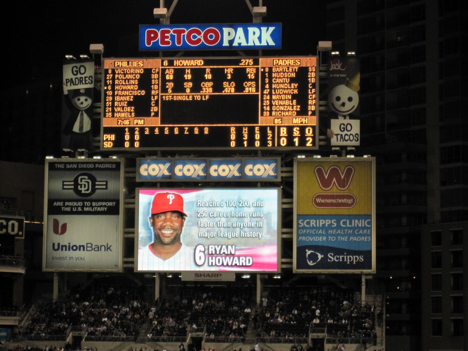
 We sat in a coffee shop for a long break before heading to Petco Park for a great ball game between the Padres and the Phillies. The park is fairly new and is extremely well laid out. The concourse is wide with concession stands, washrooms and friendly staff everywhere. Cheap tickets are a mere $10 and so it is a very affordable park. They even give a senior discount to those over 60. We were two of over 33,000 in attendance who chose good seats. The Phillies won...2-0.
We found our way back to our RV park using public transportation and a cab. The KOA Park is gated and so we had to use a security code to get in as it was late....but cool to see the gate slide open after punching in a few numbers. After 13 hours in San Diego we were ready for sleep. Tomorrow was going to be Tijuana day but we are rethinking it as the cab driver told us that the waits to come back to the US are very long...up to four hours! We will see what the morning brings.
Sent from my iPad...sure wish I could share some pictures.
Getting to downtown San Diego using public transportation proved to be very easy. Five dollars gets you a full day pass. A five minute walk to a bus stop, a five minute ride and a transfer to a fast train took us to the Gaslamp Quarter. This district consists primarily of restaurants and small shops. We walked around for about thirty minutes and stumbled upon our favorite ways to see a city; a hop on, hop on bus. The tour was narrated by a very entertaining driver. The bus made twelve different stops around the city and we were free to get off and on at any of those stops all day. We certainly saw a lot of San Diego and put a lot of miles on our sneakers...Old Town, Little Italy, the Seaport, Coronado Island (with some fabulous beaches), Balboa Park and the Embarcadero (Spanish for fort).
San Diego has a great climate. The average temperature is around 70 degrees. The best thing is that it does not vary much. Unfortunately it has been a bit cool of late...cool being in the high 60's. They get very little rain, 10 inches per year if they are lucky. The Colorado River supplies their water.
San Diego was only developed by the Spanish when they felt threatened by of all people, the Russians! San Diego is a navy town where both the Marine Corps and the Navy Seals are trained. Interestingly enough, the Marine Corps training base is just for men but the General in charge of the base is a woman. There are some big ships in the harbor, including the Midway, an enormous aircraft carrier that is now a museum.
We found our way back to our RV park using public transportation and a cab. The KOA Park is gated and so we had to use a security code to get in as it was late....but cool to see the gate slide open after punching in a few numbers. After 13 hours in San Diego we were ready for sleep. Tomorrow was going to be Tijuana day but we are rethinking it as the cab driver told us that the waits to come back to the US are very long...up to four hours! We will see what the morning brings.
Sent from my iPad...sure wish I could share some pictures.
Friday, April 22, 2011
April 21, San Diego
San Diego
The freeways and highways we have driven on in California have been in rather bad shape...lots of bumps, cracks and potholes! It is hard to believe that the state with the most vehicles has highways in such conditions. Needless to say, the pots, dishes and cutlery did lots of rattling as we cruised down the freeway to the famous San Diego Zoo.
 We arrived at the zoo with no expectations but had read that it is the most visited zoo in North America. The zoo was awesome! In fact, we spent four hours walking around, enjoying the animals. We watched monkeys groom each other, a polar bear eating carrots, pandas enjoying stalks of bamboo, zillions of birds, elephants, zebras, gazelles, hippos, koalas, a dog and a cheetah who are best friends, a month old giraffe and so much more. Did you know that when a giraffe gives birth she does so standing up. Therefore the baby is dropped six feet! This not only cuts the cord, kick starts the breathing. We ended our day at the zoo by taking the aerial ride across the park. This zoo is for kids of all ages.
We made our way to the Chula Vista KOA which is a classy RV campground, complete with pool, spa, and very friendly staff. It was warm and felt great to eat outside under the canopy. A walk around the park and a couple games of "Bananagrams" completed the day.Tomorrow we will use public transportation to get downtown and take in a ballgame at Petco Park.
Sent from my iPad
Thursday, April 21, 2011
April 20, Los Angeles to San Diego
Los Angeles to San Diego
We started calling The Ellen Show at 9 am in the hopes of getting tickets for today's show. Unfortunately we didn't get in, so we drowned our sorrows at McDonald's before leaving for San Diego.
 Driving through Los Angeles is four lanes of traffic that seems to be never-ending. However, I guess that is to be expected of a city with a population of over three million people. Eventually we got to the Pacific Coast Highway and were able to drive at a more leisurely pace, even though it was still quite busy. Today's view consisted of beaches and more beaches. We stopped at Huntington Beach, walked on the beach and watched some surfers ride the waves.
We arrived at Santa Fe RV Resort in San Diego at around three. After spending the past three nights without power we were glad to plug in, charge the battery, the iPad, the camera battery and the phone. A load of laundry, a game of pool and dinner cooked in the van completed the day. Tomorrow we're going to the San Diego Zoo.
Sent from my iPad
Wednesday, April 20, 2011
April 18, San Simeon to Oxnard
San Simeon to Oxnard
This morning it felt like waking up at a campsite in Nova Scotia. It was cool and damp because the fog was in on the beach. However, it quickly retreated and the sun came out as we finished our breakfast at the beach and headed south.
Our first stop was Solvang, an authentic Danish town town founded by immigrants from Denmark 100 years ago. We had coffee and some great pastry at a local coffee shop/bakery before heading to the Santa Ynez Mission, one of 21 missions, built in the early 1800's by the Spanish. The Priests brought native families to the missions to try to "civilize" them and turn them into Christians. Many of these adobe structures are both museum sites and parish churches.

In Santa Barbara we stopped at the Mission Santa Barbara which overlooks the city and the ocean. It was all but flattened by the 1812 earthquake. A tidal wave in that same year swept away most of the town. Santa Barbara is a very wealthy looking town where most of the buildings reflect a Spanish style.
From Santa Barbara we drove along the coast to Ventura where we stopped at the marina to look at the ocean and the fishing and pleasure boats at the dock. We ate dinner at a small fish restaurant on the dock.
At Oxnard we got to gaze out at the Channel Islands. Although we didn't see any, we were told that whales frequently travel the coast between the shore and the islands. After a trip to the Public Library to get online for a few minutes we stopped at Starbucks for tea and the it was off to bed. Today was a bust day. Tomorrow, LA.
Sent from my iPad
April 19, Oxnard to Los Angeles
Oxnard to Los Angeles
 We are very fortunate to be staying in a friend's driveway...a friend who wanted to show us around LA. The three of us left (in her vehicle) at around 9 and decided to stop at the Presidential Library of Ronald Reagan. Although I was a bit apprehensive, I was very pleasantly surprised. It was the first time I had ever been to a Presidential Library and am now grateful for the experience. The library contains artifacts, speeches, diaries, film footage, and many personal items from the two terms that Reagan served as president. There was even the suit, with bullet hole and blood stains, that he wore when he was shot.
Reagan's personal story is quite intriguing and although I didn't agree with some of his policies, I have to admit that he was a remarkable man who achieved a lot both during his terms as Governor of California and as President of true United States. The most fascinating part for me was to experience the history of the world during his presidency...everything from the fall of the Berlin Wall to the Iran Contra Scandal. The library is indeed a history museum!
Also in this library is Air force One...the actual plane that Presidents used to travel. When the plane was retired it was added to the collection and open for the public to walk through. You can imagine how enormous the building has to be to house an airplane!
 The final stop on the tour was the gravesite of Ronald Reagan. Reagan announced in 1994 that he had Alzheimer's. He shared his illness with the world to bring to the forefront the reality of this disease. His wife Nancy took care of him until he died. Included in the library is a letter that Nancy wrote to then President Bush, encouraging him to promote stem cell research.
We left the Presidential library after spending three hours there.
The rest of the day was a decidedly different experience as we headed to Hollywood. We managed to find a place to park, which I understand is nothing short of a miracle in this city, and started walking with heads down as we were on Hollywood Boulevard, reading the names of the stars in the sidewalk. A tour of Hollywood in an open top van gave us a good look at the Hollywood sign, Sunset Boulevard, Rodeo Drive and many houses belonging to the rich and famous including Halle Berry, Tom Cruise, and many, many more.


We drove back to Oxnard via the Pacific Coast Highway and got to see more fabulous homes as well as the Malibu Pier, some sites where "shoots" often take place and some restaurants frequented by Hollywood stars.
After a 12 hour day we were ready for a good night's sleep when we arrived back at the camper. What a fun day!
 We are very fortunate to be staying in a friend's driveway...a friend who wanted to show us around LA. The three of us left (in her vehicle) at around 9 and decided to stop at the Presidential Library of Ronald Reagan. Although I was a bit apprehensive, I was very pleasantly surprised. It was the first time I had ever been to a Presidential Library and am now grateful for the experience. The library contains artifacts, speeches, diaries, film footage, and many personal items from the two terms that Reagan served as president. There was even the suit, with bullet hole and blood stains, that he wore when he was shot.
 Reagan's personal story is quite intriguing and although I didn't agree with some of his policies, I have to admit that he was a remarkable man who achieved a lot both during his terms as Governor of California and as President of true United States. The most fascinating part for me was to experience the history of the world during his presidency...everything from the fall of the Berlin Wall to the Iran Contra Scandal. The library is indeed a history museum!
Also in this library is Air force One...the actual plane that Presidents used to travel. When the plane was retired it was added to the collection and open for the public to walk through. You can imagine how enormous the building has to be to house an airplane!
 The final stop on the tour was the gravesite of Ronald Reagan. Reagan announced in 1994 that he had Alzheimer's. He shared his illness with the world to bring to the forefront the reality of this disease. His wife Nancy took care of him until he died. Included in the library is a letter that Nancy wrote to then President Bush, encouraging him to promote stem cell research.
 We left the Presidential library after spending three hours there.
The rest of the day was a decidedly different experience as we headed to Hollywood. We managed to find a place to park, which I understand is nothing short of a miracle in this city, and started walking with heads down as we were on Hollywood Boulevard, reading the names of the stars in the sidewalk. A tour of Hollywood in an open top van gave us a good look at the Hollywood sign, Sunset Boulevard, Rodeo Drive and many houses belonging to the rich and famous including Halle Berry, Tom Cruise, and many, many more.


We drove back to Oxnard via the Pacific Coast Highway and got to see more fabulous homes as well as the Malibu Pier, some sites where "shoots" often take place and some restaurants frequented by Hollywood stars.
After a 12 hour day we were ready for a good night's sleep when we arrived back at the camper. What a fun day!
Tuesday, April 19, 2011
April 17 Carmel Valley to San Simion
I forgot to mention in yesterday's entry that as we entered downtown Monterey, we came upon a rally...it was a political rally, a Tea Party rally to be exact. We could clearly hear the speaker slamming the government. We knew it was a Tea Party rally because that's what their t shirts said.
 This morning we left Carmel Valley at around 10 and headed for Hearst Castle. Since highway 1 is closed due to "slides" we had to find an alternate route. We chose the road less traveled and drove through cattle country and wine country. At times the road was one lane, and the turns were hairpin but the scenery was spectacular.
We arrived at Hearst Castle, which is high on a mountain top overlooking the Pacific Ocean, just in time for our tour. William Randolph Hurst donated this castle and the surrounding land to the State of California so that many could enjoy it. It is now a State Park. Hurst was an extremely wealthy man who not only inherited a fortune but made a fortune. His father's money came from silver and Randolph increased the family fortune in the newspaper business.
After a European tour with his mother when he was ten years old, Randolph became obsessed with antiquities and so began his life long hobby of collecting works of art from around the world. The castle contains works that are as old as any you would find in the great capitals of Europe. Marble statues, ornate ceiling tiles, gold leaf, tapestries, and even an Egyptian statue from 400 AD are just some of the wonderful pieces we saw on our tour.

During it's day the castle had many famous visitors. Mr. Hurst entertained movie stars, industrialists, athletes and the political elite in his "camp hill". As we walked through the dining room and through the guest houses we could almost hear the sounds of the guests as they left the dining room after dinner and sauntered towards the movie theatre where the evening's entertainment always included a movie. Hurst owned movie studios as well as newspapers. Our tour also included a visit to both the outdoor and indoor pools which looked more like Roman baths than swimming pools.
After three hours at Hurst Castle we made our way to San Simeon State Park where we will stay for the night. There is no power hookup here, but this vehicle has a generator, just in case we need it. We love this RV...stovetop, fridge, microwave, stereo and even a television...all in 19 feet!
Sent from my iPad
Saturday, April 16, 2011
April 16, Oakland to Carmel Valley
After breakfast at our hotel in Oakland we got a cab to take us to Apollo RV where we picked up our 19ft RV. Due to the one hour, detailed orientation we left there feeling very confident and thrilled to be on the road. With help of a GPS, navigating out of San Leandro was easy. We headed for the well known scenic route down the coast known as highway 1. It was easy to tell we were close to Highway 1 when we saw the patches of fog. In spite of the fog, the weather was much warmer than it has been.
 Highway 1 led us to scenic Monterey and the very popular 17Mile Drive which begins at Pacific Grove, winds along beaches, through forests and the famous Pebble Beach area. Amongst the spectacular scenery are some of the most expensive homes in California. We stopped a couple of times to admire the scenery and to browse in the shops at Pebble Beach and to take a few pictures.
We had planned to spend the night at Big Sur but Highway 1 near Big Sur is closed due to a mudslide. Our final stop for the day was Carmel By the River RV Park where we settled in for the night.
Sent from my iPad
April 15, Oakland
We met a woman from Oakland while on the Castro walking tour who told us that Oakland was not safe and that we should "never walk" while in Oakland. As you can imagine she had us just a little paranoid as we headed to the BART (Bay Area Rapid Transit) station three blocks from our hotel, to catch the train to Oakland. We knew that we were very safe on the San Francisco side but had no idea what awaited us on the Oakland side.

 Needless to say, when we reached our stop in Oakland, we were not mugged, or approached by anyone! We very easily found a cab that took us the 1.5 miles to our hotel. We chose this hotel because it is within walking distance to the Oakland Coliseum, home of the Oakland Athletics. Both the cab driver and the hotel staff told us that it is perfectly safe to walk to the ballpark and walk we did!
The Oakland Coliseum is an old park in a rather run down area of the city, but that didn't take anything away from the great atmosphere inside the park. We had excellent seats, the pitching was great, but unfortunately the home team lost in extra innings. We walked back to our hotel...safe and sound.
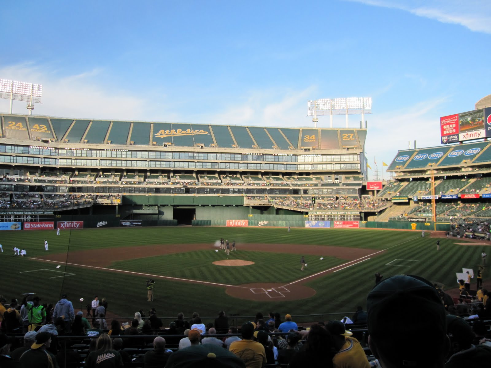
 Needless to say, when we reached our stop in Oakland, we were not mugged, or approached by anyone! We very easily found a cab that took us the 1.5 miles to our hotel. We chose this hotel because it is within walking distance to the Oakland Coliseum, home of the Oakland Athletics. Both the cab driver and the hotel staff told us that it is perfectly safe to walk to the ballpark and walk we did!
 The Oakland Coliseum is an old park in a rather run down area of the city, but that didn't take anything away from the great atmosphere inside the park. We had excellent seats, the pitching was great, but unfortunately the home team lost in extra innings. We walked back to our hotel...safe and sound.
Thursday, April 14, 2011
April 14, San Francisco
 In order to catch the 9:10 ferry to Alcatraz we left the hotel at 7:30. We had decided to walk the 1.5 miles to Pier 33 so that we could experience yet another view of San Francisco. We are urban hikers. The ferry ride was short but afforded a great view of the Golden Gate Bridge and the city. We were again dressed in layers as it was chilly in the harbor and on the island.
We saw individual cells, solitary confinement, the recreation field, the prisoner's dining hall, the library and the holes in the wall where three prisoners chipped away for over a year to make the hole big enough for an escape. Although they did escape it is not known what happened to them. Some say they got to South America while most believe they perished in the cold current in San Francisco Bay. Outside the walls of the prison there were many birds nesting and lots of flowers making for a very peaceful setting. We stayed on the island for over three hours and thoroughly enjoyed Alcatraz.
April 13 San Francisco
 This morning the forecast indicated that we might experience showers and that dressing in layers would be a good idea. Feeling bulky, yet warm we set out to catch a bus to the Presidio and The Golden Gate Bridge. The 30 minute bus ride took us through Japan Town, past the University of San Francisco through the Laurel Heights District to Presidio National Historic Park.
By the time we got to the Bridge, the clouds were gone and the sun was out. It was, however, windy on the bridge but that is of course, the norm. The walk across is about 1.6 miles of spectacular views. I am surprised that I didn't bump into people as it was hard to look where I was going with the incredible view of the Pacific on one side and the city of San Francisco on the other.
 We felt like locals as we easily navigated the bus system back to Union Square where we looked for and found the Boudin Bakery Cafe for a very fresh sandwich and a hot bowl of soup. After lunch we joined the other tourists and the locals who spend time sitting on the grass and benches on the square and just watch the world go by.
Although we are not "shoppers" we did walk through Macy's and the Levi's store. With no purchases in hand we walked back to our hotel and labeled the day a resounding success.
Sent from my iPad
Wednesday, April 13, 2011
April 12 San Francisco
Although we could have taken the bus, we chose to walk an hour to get to the Castro District where we met a walking tour. The city, through the Public Library system, offers tours of various locations throughout the city. The tour group included four from France, one from Italy, one from Germany, two Americans and six Canadians.
 Our tour guide told us the history of the district, and pointed out places of interest, including many very expensive Victorian homes. A very nice, but relatively modest home now sells for over one million dollars. The Castro has become a very trendy place to live. Although it is still considered the gay capital of the USA, the population of the Castro is aging and changing so that now, rather than all, only 75per cent of homes are gay owned. The Castro became well known in the 60's and 70's as the place where people campaigned and fought for gay rights. Harvey Milk lived here, served as a district supervisor and was shot, along with Mayor Moscone in 1978. A park is named after Harvey, along with several shops and most notably an elementary school that focuses on civil rights education.
 After lunch at a restaurant where the locals eat, we chose the bus as our mode of transport back to our hotel. After a two hour rest, we set out on foot again,this time for A T & T Park where the World Series winning San Francisco Giants played their arch rivals the LA Dodgers. It was a great game with the Dodgers going ahead 3 - 0, before the Giants came alive and won the game 4 - 3. It was very cold and windy at A T & T Park tonight...a mere 45 American degrees! Even so, it was a treat to experience this famous ballpark; to see the boats in McCovey Cove and sit amongst the fanatic Giants fans as they chanted and cheered for their team. Thankfully the ride home was warm. The bus driver had the heaters on full blast.
 Our tour guide told us the history of the district, and pointed out places of interest, including many very expensive Victorian homes. A very nice, but relatively modest home now sells for over one million dollars. The Castro has become a very trendy place to live. Although it is still considered the gay capital of the USA, the population of the Castro is aging and changing so that now, rather than all, only 75per cent of homes are gay owned. The Castro became well known in the 60's and 70's as the place where people campaigned and fought for gay rights. Harvey Milk lived here, served as a district supervisor and was shot, along with Mayor Moscone in 1978. A park is named after Harvey, along with several shops and most notably an elementary school that focuses on civil rights education.
Monday, April 11, 2011
April 11 San Francisco

 Up early for coffee and muffins in the lobby of our quaint hotel, The Grant. Although cool this morning (about 50 American) it looks like it will be a nice day. We thought we were going to take a "hop on, hop off" bus tour but after waiting almost an hour at the stop and no tour bus came, we decided to walk. We discovered that San Francisco is easy to see on foot as long as you don't mind very steep hills.
Our first stop was the 210 foot tall Coit Tower, built with money left to the city by philanthropist Lillie Coit. The tower is in the shape of a fire hose nozzle because Lilly so admired the firefighters who fought the 1906 earthquake fires. The views from the top of the tower are spectacular.
A walk down Telegraph Hill led us to the Piers where we found Sally's Famous Fish, a take out that specializes in fresh haddock "fishwiches" prepared before your eyes. It was by far the freshest haddock I have ever tasted! After lunch we set out on foot again and ended up at the Ghirardeli Chocolate factory where we forced ourselves (because of the rave reviews) to try their very special hot fudge sundae...yum!
Needing to walk off all that food we decided to tackle the steepest street in San Francisco...Hyde Street with a 31.5 per cent grade. On the way up we stopped to watch cars navigating the "crookedest street in the world, Lombard Street. Its eight switchbacks were installed to reduce the steep grade from 27 per cent to 16 per cent.
Walking all the way to Civic Centre we were thrilled to take pictures of each other next to the bust of Harvey Milk at City Hall. We also witnessed a couple of weddings and could hear the council in session behind closed doors.
Walking through the Tenderloin District we noticed many homeless people but were only approached by a few. We did, however see a dead body on the sidewalk with two police officers standing near her. It was a shocking sight but no one around us seemed shocked! People were just going about their business.
On our walk back to the hotel we stopped at a small market and bought a few items for our fridge. With sore feet and tired eyes we ended our first full day of exploring the streets of San Francisco.
Sent from my iPad
April 10 San Francisco
Up at 3:30 this morning. Flight at 6:30 on time. Flight at 10:00 in Toronto on time. Long flight but watched "Incindes" and two episodes of "Raising Hope."

 We arrived at Grant Hotel, checked in and headed down the street to catch the cable car. The cable car stops in the middle of the intersection to pick up and let people off. We walked around the extremely touristy Fisherman's Wharf and Pier 39. Ate a freshly prepared shrimp crepe and watched the sea lions fight for space on the docks.
Got to ride the cable car "hanging on" on the way back from the wharf.
Exhausted, we returned to the hotel and worked at staying awake. As I write this and keep one eye on the ball game on tv, I see that although it is 7 pm here, my internal clock tells me that I have been awake for 18 hours. I will soon be ready to just give in and fall asleep. San Francisco will be explored further tomorrow, possibly using a "hop on hop off" bus so that we can see all the highlights in one day.
Friday, April 8, 2011
Subscribe to:
Posts (Atom)