Saturday, April 30, 2011

April 29, Sacramento to Arcata


Luckily we had a full propane tank because the temperature dipped down to about 40 last night. However it warmed up quickly as we set out to head north. We traveled on the freeway for about two hours to reach the scenic drive from Redding to the Pacific Coast.

As we headed west we could see snow capped mountains in the distance and knew that we would have to get to what was on the other side of them. The mountains are part of the 2.1 million acre Shasta Trinity National Forest, the largest in California. This forest has 6278 miles of streams and rivers. The road curved and twisted alongside the Trinity River for many miles. We drove through dense forests, up mountains, down mountains and finally reached the coast.

We drove for six hours today and so were pleased to get a spot at the Mud River Rapids RV Park. Tomorrow we will drive through the Redwood Forest. A change of wardrobe is definitely in order...we will have to dig out the jeans and socks.


Sent from my iPad

Friday, April 29, 2011

April 28, Yosemite National Park to Sacramento

April 28, Yosemite National Park to Sacramento

It was cold last night. The temperatures often dip into the low 30's here at this time of year. Fortunately we have a great furnace, but unfortunately we were low on propane and therefore didn't have it turned up as high as we would have liked. One of the first things we did this morning was to fill the propane tank!

Yosemite National Park consists of about 1200 square miles of wilderness,  meadows, giant forests, enormous granite peaks and waterfalls. There are many scenic stops on the way to Yosemite Valley, and along with many others, we stopped frequently, took tons of picture, walked some of the trails and visited all the displays. We didn't do any serious hiking as we didn't have all the necessary equipment. The waterfalls in Yosemite are spectacular and due to lots of rain and snow this past winter the streams are full. As far as wildlife is concerned, we didn't see any bear but we did see deer, chipmunks and lots of birds.

As we left Yosemite we found ourselves comparing it to the other two National Parks that we visited; Joshua Tree and Sequoia. We both agreed that so far Joshua Tree is our favorite with Sequoia coming in second. Yosemite is amazing, but, in our opinion, just not as amazing as the other two we have visited.

We continued north and landed in Sacramento at around 5:30. We chose another KOA as we find them to be very well laid out, extremely clean and secure.

Tomorrow we will head for the last "must see" on our list: The Redwood Forest, fully aware that we will be leaving the warm temperatures and entering the 60 degree zone!


Sent from my iPad

Thursday, April 28, 2011

Aprl 27, Sequoia State Park to Midpines (Yosemite)

April 27, Sequoia State Park to Midpines (Yosemite National Park)

We paid our $20. 00 fee and entered Sequoia State Park at around 10:30. We could see snow on the mountains far in the distance but had no idea that before the end of our day in Sequoia we would be walking on that snow. The road through the park is a gradual climb to over 8000 feet. Most of the hiking trails were closed due to snow so since we didn't bring our snowshoes (although we did see one family with theirs) our hiking was limited to a walk up a snow covered trail to see General Sherman' sTree. This giant sequoia tree is estimated to be 2500 years old and has a circumference of 103 feet. In volume of total wood, this is the world's largest tree.

We drove through the Giant Forest, an area where all of the trees aspire to be as tall as General Sherman's Tree which stands at 275 feet. Standing at the base of one of those trees sure made me feel small. There were many scenic pull off sites along the drive and we took advantage of many to take pictures and just gaze at the spectacular views.

We programmed Richard (our GPS voice) to take us towards Yosemite and to a grocery store so that we could replenish our food supplies. We arrived at the Yosemite West/Mariposa KOA at around 6:30 and settled in for the night. Tomorrow we will visit Yosemite.


Sent from my iPad

Wednesday, April 27, 2011

April 26, Barstow to Three Rivers (Sequoia National Park)

April 26, Barstow to Three Rivers (Sequoia National Park)

Besides being half way between Las Vegas and Los Angeles and being near a ghost town, Barstow has one more claim to fame: outlet shopping. Although neither of us are shoppers we did have a few things on our "need" list and so we spent some time at the Barstow Outlet Mall and the outlet mall in Tulare. Our "need" lists are now empty.

Our goal for the day was to get as close to Sequoia National Park as possible. For the first hour or so, our drive was on more of the Mojave Desert where we saw the testing site for KIA and Hyundai automobiles, Edwards Air Force Base and the Marine Aircraft Test Site. There is definitely a military presence in the desert.

The transition from desert to fertile valley was sudden. It was as if we merely crossed a line and all of a sudden we were seeing grass, trees, rolling hills and farmland. We had entered the San Joaquin Valley. We came across a farm market that sold fresh fruit, dried fruit, nuts and dates. Needless to say, we filled a basket with goodies and had lots to munch on for the rest of the drive. We passed acres and acres of apple orchards, orange groves, lemon groves, grapefruit groves and vineyards. Unfortunately, we also passed farms for sale, boarded up buildings and idle factories.

We arrived at Three Rivers Hideaway RV Park at around 6. After dinner we walked to the river, took a couple of pictures and planned our day tomorrow. We will spend most of it in the Sierra Nevadas, Sequoia National Park where I understand the bears have come out of hibernation.


Sent from my iPad

Tuesday, April 26, 2011

April 25, Joshua Tree to Barstow

Joshua Tree to Barstow

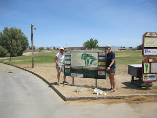
After doing some laundry we headed for the golf course. It was very windy and hot...83 to be exact. We played nine long holes, most being par 5's. It was a fun morning. We had lunch at a local cafe that has a very good reputation. Apparently the owner grew tired of the computer business and bought this small restaurant. Both she and her husband cook and wait on the six tables.

A drive through the Mojave Desert with high winds provided some fascinating scenery as the dust could be seen blowing from miles away. We ended up in Barstow, a town that is half way between Las Vegas and Los Angeles. Just outside Barstow we visited an old mining town called Calico Ghost Town. Silver was discovered there in the early 1800's. It is now an authentic Wild West Town where you can imagine its past as you roam the streets.

We settled in to the Barstow/Calico KOA for the night. Tomorrow we head for Sequoia National Forest.


Sent from my iPad

Monday, April 25, 2011

April 24, Salton Sea to Joshua Tree National Park

Salton Sea to Joshua Tree National Park

We woke up early this morning to the pleasant sound of a bird choir. A walk to the beach, a wave to the park host, followed by breakfast started the day. Thanks to the bird choir we hit the road early, heading for Joshua Tree National Park. The area we were passing through this morning is  the "date" centre for California, but unfortunately, due to it being Easter Sunday, the date place I wanted to visit was closed. We did, however enjoy the drive through the very affluent areas of Palm Desert and and Palm Springs.

We got to Joshua Tree National Park at around noon and stopped at the visitor centre for some information and maps of hiking areas. We got a pleasant surprise when we were told that entry to the park was free due to it being National Parks Week in California. The Park is a whopping 790,000 acres, with lots of camping, rock climbing and hiking, all affording fantastic views.

Our first stop was Keys View, a look off area, where on a clear day, looking south, you can see all the way to Mexico. The view to the west is blocked by a wall of cloud which we were told is a result of smog from Los Angeles and industrial areas. From this view we also saw the San Andreas Fault line.

Our next stop was a short hike through Hidden Valley, a place where it is thought cattle rustlers would hide out. It truly looks like the setting of an old western with lots of varieties of cactus, some gorgeous desert flowers, and of course, Joshua trees. We did see some wildlife...some kind of rodent, birds, and lizards but fortunately none of the four varieties of rattle snakes found in the park.

The park ranger also recommended the Barker Damn hike, another loop trail that went up and over and around the many enormous boulders in the park. On this hike we saw petroglyphs and one of the very few areas in this desert park where there is water...a very small desert oasis.

We left the park after four hours of exploring and headed to Twentynine Palms RV Resort. A swim in the indoor pool and a shower was refreshing after the heat and dust of the day at Joshua Tree. After dinner we walked to the adjacent golf course and made plans to play nine holes in the morning.

Life is good!


Sent from my iPad

Sunday, April 24, 2011

April 23, San Diego to Salton Sea

San Diego to Salton Sea

We pulled out of Chula Vista KOA at around 10 and headed for the gas station and grocery store. After replenishing our supplies we took Highway 94 east, a highway that skirts the Mexican border. In fact, we saw about 30 Border Control Officers and were stopped at two checkpoints. I even asked one officer if I could take his picture. Jokingly  he said, "for five dollars" and laughed as the shutter clicked. I was intrigued by the amount of security along this route. There were dogs, guards, helicopters, barbed wire fences and a very high metal fence at the point where the road actually touches the Mexican border.

The landscape along here was mountains and rocks...lots of rocks. After turning north the landscape change to more desert like and it was hot. We passed through several small towns where all of a sudden we would see lots of vegetation. As soon as we drove out of the town, the vegetation ended and we saw desert again.

We arrived at Salton Sea at around 5. Salton Sea is actually an inland body of water that was formed when irrigation damns broke due to flooding on the Colorado River. The water flowed for 16 months and this lake was formed...40 miles long and 20 miles wide...the largest body of water in California. It is now very salty and is evaporating quicker than it is being replenished and is therefore shrinking. The lake is full of fish and many birds stop here on their north/south flight. We are 228 feet below sea level here.

I had a great chat with the park host, we walked along the beach and stayed well back of the sagebrush because there is a sign indicating that there are rattlesnakes in there! Tomorrow we will visit Palm Springs and Joshua Tree National Park.


Sent from my iPad